


The text is from here.
Yokohama
Last updated on May 2, 2024.
Yokohama
Please use "Yokohama Map (outside site)" for contents shown in <map that you can see> below the inhabitant of a ward life map of each ward.
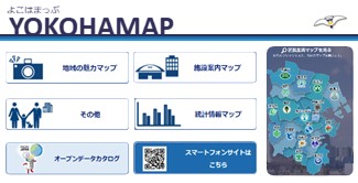
<Maps you can see>
- Inhabitant of a ward life map of each ward
- A picture map of the history of Naka Ward
- Modepoyo Map (Hodogaya Ward Child Care Information)
- Yokohama Former Tokaido Hodogaya-juku Highlights and Specialty Introduction Map
- River and sea creature survey point map
- "I'll have you! Tsuzuki Vegetables Store Map
- "Continuing Green and Flower Famous Places 25" Map
- Totsuka Ward History Map
- Minami Ward Medical Institution Map
- Kanazawa Ward clinics, Pharmacy, etc.
- Yokohama City Library Map
- Resources and Waste Recycling Bureau Public Toilets Map
- Disability welfare facility map
- Aces MAP
- WebGIS version of Kohoku Ward Neighborhood Association Neighborhood Associations Area Map
- Yokohama Green Up Project Forest Land conservation Map
- Elementary and junior high school commuting area map
- Barrier-free basic concept map
- Municipal farm map
- Statistical information map
Related information
Statistics (jSTAT MAP) (outside site) viewed on map
Statistics on the map (jSTAT MAP) are geographic information systems that anyone can use. (Statistics Bureau, Ministry of Internal Affairs and Communications)
Inquiries to this page
Policy Administration Bureau Data Management Division
Phone: 045-671-2028
Phone: 045-671-2028
Fax: 045-663-4613
E-Mail address [email protected]
Page ID: 461-650-303


