


現在位置
- Yokohama-shi Top Page
- Living, procedures
- Community Development and Environment
- Roads
- Thing about procedure of road
- Reading of road ledger drawings
Last updated on March 18, 2025.
The text is from here.
Reading of road ledger drawings
Reading of road ledger drawing (viewing time 8: 45-17: 00)
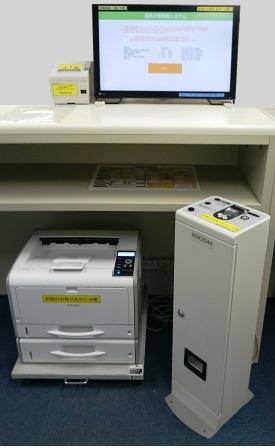
The road ledger drawing can be viewed and printed (paid) on the second floor of the city hall "Yokohama Building Information Center" and the "Road Ledger Reading System" (image: 33KB) installed in each ward in Public Works Office.
In addition, we can read in Internet administration map information system road ledger figure information "Yokohama no Michi" (outside site).
There may be a time difference in updating the information of "Yokohama no Michi", so please check the time of creation and update on the Terms of Service screen before viewing.
If you are applying for a copy of the drawing or copy certificate of the road ledger map, please refer to "Grant of drawing copy / copy certificate" from the list of related pages at the bottom of this page.
Information that can be viewed and printed with the "Road Ledger Reading System" (image: 33KB)
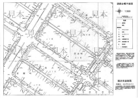
・Road ledger floor plan (image: 33KB)
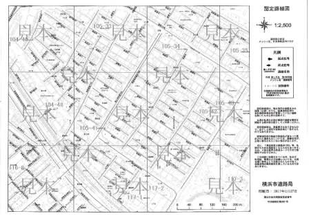
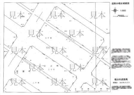
・Road ledger area map (image: 22KB)
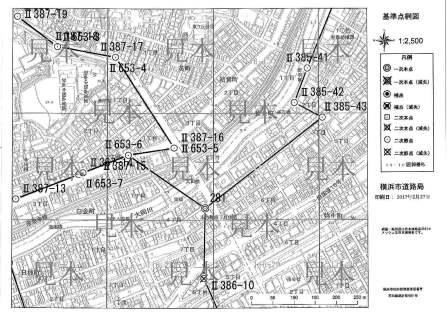
・Authorized route map (image: 34KB)
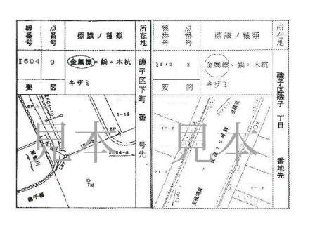
・Yokohama-shi public reference point network map (image: 42KB)
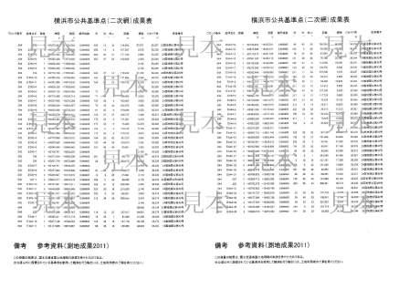
・Yokohama-shi public reference point result (image: 26KB)
・Record of Yokohama-shi public reference point (image: 28KB)
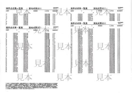
・Boundary point coordinate value (image: 23KB) (In the road ledger area map, only the boundary mark where the number is assigned is a reference value.)
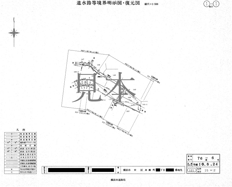
・Road and waterway boundary survey map (image: 122KB)
Information that can be viewed on the Internet Administration Map Information System Road Ledger Map Information "Yokohama no Michi" (outside site)
・Road Ledger Floor Plan
・Road Ledger Area Map
・Authorized route map
(Please understand in advance that the road ledger map information "Yokohama no Michi" may not be printed at an accurate scale or characters may overlap.)
| Drawing type | Road ledger browsing system | Road ledger map information "Yokohama no Michi," | |||||
|---|---|---|---|---|---|---|---|
Browse | Printing | Scale | Browse | Printing | Scale | ||
| Road Ledger Floor Plan |
|
| 1/500、1/1,000 |
|
| 1/500(1/250※) | |
| Road Ledger Area Map |
|
| 1/100、1/200、 |
|
| 1/500(1/250※) | |
| Authorized route map |
|
| 1/2,500、1/5,000 |
|
| 1/2,500(1/1,000※) | |
| Yokohama City Public Control Point Network Map |
|
| 1/2,500、1/5,000 |
|
| ― | |
| Yokohama City Public Reference Point Results |
|
| ― |
|
| ― | |
| Notes of Yokohama City Public Reference Point |
|
| ― |
|
| ― | |
| Boundary point coordinate value |
|
| ― |
|
| ― | |
| Road and waterway boundary survey map |
|
| 1/500 |
|
| ― | |
△Please understand beforehand that the road ledger map information "Yokohama no Michi" may not be able to print at an accurate scale or characters may overlap.
※The scale of parentheses in the road ledger map information "Yokohama no Michi" is only for viewing.
What is a road ledger drawing?
Based on Article 28 of the Road Law, it is a drawing that is required to be provided to road managers for preparation, management and inspection.
In Motoichi, we divide road ledger drawing into floor plan (image: 33KB) and area line drawing (image: 22KB) and prepare. (The scale is 1/500.)
Inquiries to this page
Road Investigation Division, Road and Highway Bureau Road Department
Phone: 045-671-2774
Phone: 045-671-2774
Fax: 045-550-4954
E-Mail address do-dorochosa@city.yokohama.lg.jp
Page ID: 926-246-181


