現在位置
- Yokohama-shi Top Page
- Living, procedures
- Community Development and Environment
- Roads
- Construction
- Bridges
- conservation in Historic buildings
Last updated on March 24, 2022.
The text is from here.
conservation in Historic buildings
Town development and certification based on history Historic buildings
In Yokohama City, we will certify and preserve the buildings that create the appeal of Yokohama, which are historical and cultural assets that are valuable in the landscape, the civil engineering industry remain and the structures that are integrated with them as "Yokohama City Certified Historic buildings".
Bridges and tunnels certified by Historic buildings (12 locations)
Legend:
1.Name 2. Location 3. Structure and scale
4.Building age 5. Designation / Certification 6. Design / Construction 7. Overview

- East Tunnel
- From 178 Iwai-cho, Hodogaya-ku to 318 Iwai-cho
- Horseshoe-shaped tunnel
- 1930 (Showa 5)
- City Certified Historic buildings "November 2000"
Civil engineering heritage "October 2006" selected by the Japan Society of Civil Engineers - Design: Yokohama City Construction: Unknown
- During the reconstruction of the earthquake, it was planned and developed in conjunction with a road tunnel to strengthen water distribution in the areas of Isogo, Okamura, Maita and Ooka. The exterior surface is made of granite on the beams and Tuscan-type pillars, and the others are made of French bricks to create an excellent design that clarifies the structural design of the beams and columns.

- Urafudobashi
- From 2-33 Urafune, Minami-ku to 3-191 Nakamura-cho
- Pin-linked Pratt Truss Bridge
- It was erected as the former Nishinohashi Bridge in 1893.
Relocated as Former Okinabashi in 1927.
Relocated as Urafune Waterway Bridge in 1989 (1989) - City Certified Historic buildings "November 2000"
- Design: Kageru Noguchi (formerly Nishinohashi Bridge) Construction: Unknown
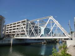
- It was originally built as Nishinohashi Bridge, but was converted to Okinabashi after the earthquake and relocated to its current location. Pin-linked Pratt Truss is a bridge form used in the middle of the Meiji era, and the Urafune Waterway Bridge is the oldest road bridge in this form.

- Shoryubashi
- From 1388 to 1404, Kuramachi, Sakae Ward
- Stone arch bridge
- From the middle of the Meiji era to before 1915 (estimated)
- City-certified Historic buildings "August 2001"
- Design: Unknown construction: Unknown
- It is the oldest stone bridge in Yokohama that retains its appearance at the time of construction. This place is the approach to the relocated Shirayama Shrine and is presumed to have been built between the middle of the Meiji era and 1915. This is an example of a valuable practical bridge among stone bridges before the Meiji era, north of Kanto, where most garden bridges are said to be.

- Hibikibashi
- From 5 Higashi-Terao Kitadai, Tsurumi-ku to 1-1 Kita-Terao
- Reinforced concrete arch bridge
- 1941 (Showa 16)
- City-certified Historic buildings "August 2001"
- Design: Kenji Imai, Ministry of Home Affairs, Yokohama Civil Engineering Branch, Shinkyohama National Highway Office
Construction: Unknown - Hibiki Bridge, which is known as "Megane Bridge", was built along with the construction of the 2nd Keihin National Highway. The area near this bridge is assumed to be the turning point of the marathon of the "Phantom Tokyo Olympics" scheduled to be held in 1940, and the light design made of concrete was later designed by architect Kenji Imai, who later worked on Momoka Rakudo in the Imperial Palace.

- Yamate Tunnel
- From 1-17 Mugita-cho, Naka-ku to 1-39 Ishikawa-cho
- Road (mountain) tunnel with arch cross section
- 1928 (Showa 3)
- City-certified Historic buildings "August 2001"
- Design: Reconstruction Bureau Construction: Hazama-Gumi
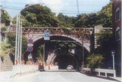
- It was built as part of the reconstruction of the earthquake and has the largest width as a pre-war road tunnel. Along with the adjacent No. 2 Yamate Tunnel, which was used for railways, it has supported the traffic connecting Kannai-District and Honmoku. The exterior surface is finished with stonework along with the adjacent Sakuramichi Bridge, and can be said to be a representative design of the early Showa era.

- Uchikoshibashi
- From Karasawa No. 1, Minami-ku to Uchikoshi No. 26, Naka-ku
- Steel Langer Bridge
- 1928 (Showa 3)
- City certified Historic buildings "November 2003"
- Design: Construction of Yokohama City Civil Engineering Bureau: Yokohama culvert company
- This bridge is a beautiful arch-shaped steel bridge built to straddle the cut-off created by laying tram tracks after the Great Kanto Earthquake. The scenery of the V-shaped space covered with masonry retaining walls and vegetation on both sides with vivid vermilion arches has the dignity of Yokohama's representative bridge and has become a regional landmark.

- Sakuramichi Bridge )
- From 1-13, Mugita-cho, Naka-ku to 1-chome, 1-17
- Reinforced concrete arch bridge
- 1928 (Showa 3)
- City certified Historic buildings "November 2004"
- Design: Reconstruction Bureau Construction: Hazama-Gumi
- This bridge was built along with the Yamate Tunnel as one of the largest earthquake reconstruction projects in the city. This project, which can be said to be a symbol of reconstruction, was designed to harmonize the design of bridges and tunnels, creating a space as a gate from Honmoku to Kannai-District.

- Kasumibashi Bridge
- From 56-18 Kasumigaoka, Nishi-ku to 89-2 Miharudai, Minami-ku
- Reinforced concrete arch bridge
- Showa 3 (1928) [Brick walls and gateposts were Taisho 2 (1913)]
- City certified Historic buildings "November 2004"
- Design: Reconstruction Bureau Construction: Unknown
- Today, Kasumibashi Bridge is the second generation built as an earthquake reconstruction project. It has a solid appearance representing the reinforced concrete arch overpass in the city, and features a plan that arranges stairs on both sides to serve as a pedestrian bridge. Together with public toilets built at the same time and brick walls and gateposts at the time of the first generation, the Civic Design of Showa from Taisho is well preserved.

- Yatobashi Bridge
- From 69 Yamashitacho, Naka Ward to 1-13 Motomachi
- Steel arch bridge
- 1927 (Showa 2)
- City certified Historic buildings "December 2005"
- Design: Yokohama City Construction: Unknown
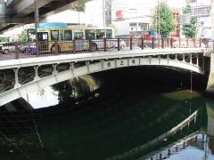
- In the past, Yatobashi Bridge was located on Mizumachi-dori-suji, but was rebuilt on the current Honcho-dori-suji after the earthquake. It is one of the few steel arch bridges in the reconstruction period, located at the junction between Yamashitacho and Motomachi, and has become an important landscape component.

- Nishinohashi Bridge
- From 277 Yamashita-cho, Naka-ku to 2-1 Ishikawa-cho
- Steel arch bridge
- 1926 (Taisho 15)
- City certified Historic buildings "December 2005"
- Design: Reconstruction Bureau Construction: Unknown
- The bridge is located at the junction of the Yamashitacho district and the Motomachi and Ishikawacho districts and serves as a gate space for both districts. Due to the fact that there are many pedestrian traffic and the main pillar is considered to be moving, but it has a high symbolic design, making it an important landscape component as a symbol of the region.

- Kasumibashi Bridge
- From 1-17-1 Shinyamashita, Naka-ku to 15-1.
- Pratt Truss Bridge
- [Building] 1896 (Meiji 29)
[Re-relocated] 2013 (Heisei 25) - City certified Historic buildings "November 2013"
- [Initial production] Handy side
[Re-relocated (design)] Yokohama City, Oriental Consultants Co., Ltd.
[Re-relocated (construction/ superstructure)] Kita Nippon Machinery Co., Ltd. and Nippon Casting Co., Ltd.
[Re-relocated (construction / substructure / installation road)] Doshida Construction Co., Ltd. and Nakabachi Construction Co., Ltd. - It was bridged as the Sumida River Bridge in 1896 (Meiji 29), and was relocated to the Shin-Tsurumi Dockyard in 1929 (1929). It was also dismantled and relocated and reborn as the current Kasumibashi Bridge on March 21, 2013. The bridge is a transitional period from the British style to the U.S. style, and is valuable as the last English truss. In consideration of the distinctive appearance at the time of construction, the initial members are reused as much as possible. On the other hand, color planning and installation road planning are also carried out closely, and the landscape value is very high as a symbol of the region.
- Yoshino Bridge )
- From 1-26-2, Yoshino-cho, Minami-ku to 1-7, Miyamoto-cho
- Reinforced concrete ramen-type abutment, Upper-type simple steel plate girder bridge (reconstruction type)
- 1926 (Taisho 15)
- City-certified Historic buildings "March 2019"
- Design: Reconstruction Bureau Construction: Shimizu Gumi (currently Shimizu Corporation)
- Yoshino Bridge has a structural feature called a so-called "reconstruction bridge" in which a ramen-type abutment made of reinforced concrete and steel girders are built between the abutments, and its existence value is recognized as a characteristic bridge that plays a part in the history of Yokohama City Bridge. In Yokohama, due to the reclamation of rivers, only the Aratama Bridge remains as a "reconstruction bridge" in addition to Yoshino Bridge.
- Chojyabashi Bridge
- From 1-24-7 Hinode-cho, Naka-ku to 9-176, Chojamachi
- Reinforced concrete filling arch bridge concrete wall type abutment
- 1928 (Showa 3)
- City-certified Historic buildings "March 2022"
- Design: Reconstruction Bureau Construction: Ikeda Gumi
- Chojyabashi Bridge has a better ground than other bridges over the Ookagawa River, and it is believed that the arch bridge with elegant curves harmonized with the landscape was selected as a symbol located in the center of the area because of its structure and landscape. The three existing reinforced concrete arch bridges, Chojyabashi Bridge, Kasumibashi Bridge and Sakuramichi Bridges, and the only Chojyabashi Bridge that spans the river is a valuable bridge that plays a part in the history of bridges in Yokohama.
Inquiries to this page
Bridge Division, Road and Highway Bureau Construction Department
Phone: 045-671-2791
Phone: 045-671-2791
Fax: 045-662-3945
E-Mail address do-kyoryo@city.yokohama.lg.jp
Page ID: 700-534-238


