


Last updated on December 12, 2023.
The text is from here.
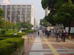
Kannai and Kangai Areas
What's New
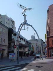
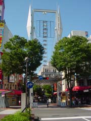
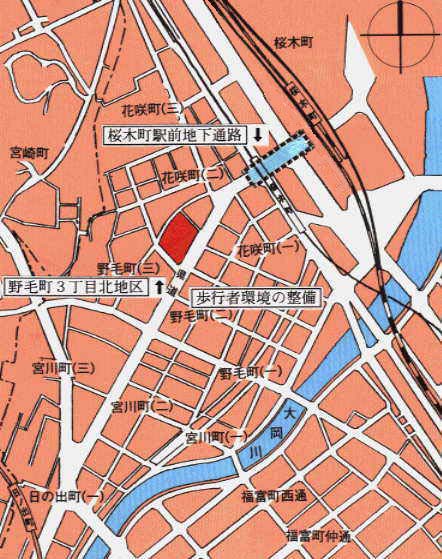
Kannai Kangai-District
Current status and issues and policies for community development
Kannai Kangai-District is a district that has unique charms such as its history, culture, and unique shopping streets since its opening of the port. In order to enhance the characteristics of each district, the District Planning Council and the Community Development Rules are in operation.
In addition, in order to accumulate urban functions and create a lively atmosphere, Kannai-District has designated a “special use district” as a “special use district” and has established a “landscape plan” based on the Landscape Act and a “cityscape consultation district” based on the Landscape Ordinance in order to create a high-quality landscape.
In addition, we are promoting the development of new industries through active guidance of cultural and artistic activities and community development through collaboration with citizens.
However, in recent years, the number of employees has decreased by about 35,000 (H8 → H18) and the value of product sales has been reduced by about half (H9 → H19), and the decline in commercial and business functions has not stopped. Revitalization is a major issue.
Therefore, in March 2010, the Kannai-Kangai-District Revitalization Promotion Plan, which defines the future image of the town to be pursued and strategies for revitalization, was formulated in March 2011, focusing on specific initiatives led by the local community.
In addition to the traditional efforts of community development organizations, initiatives in which multiple community development organizations cooperate, such as the promotion of the Y151-200 opening commemorative event, have also begun.
Business Overview
As part of our efforts to prioritize the revitalization of the Kannai and Kangai-District, we are working to strengthen the junctions around Kannai-sta.-kitaguchi and improve the pedestrian environment.
Process
April 2006 Designated and started operation of the Yokohama city center function guidance area
April 2008 Operation of the Landscape Plan and the Urban Landscape Consultation Area
March 2010 Formulated the Kannai-Kangai-District Revitalization Promotion Plan
March 2011 Kannai-Kangai-District Revitalization Promotion Plan Action Plan Formulated
Established Kannai-Kangai-District Revitalization Council in December 2012
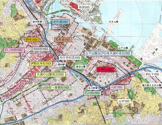
Location map of Kannai and Kangai-District
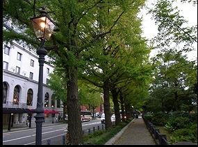
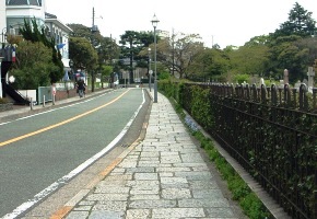
Areas around Yamashita Park and Nihon Odori Avenue
Current status and issues and policies for community development
The area, which faces Yamashita Park and Nihon Odori Avenue, is a district that conveys the history of Yokohama since its opening, and is a popular tourist destination with Yamashita Park, Chinatown, Motomachi and Yamate.
It is necessary to create a lively space that integrates with a row of ginkgo trees, a cityscape with Historic buildings, and a spacious pedestrian space.
We aim to create a traditional and stately cityscape by preserving and utilizing attractive local resources and Historic buildings.
Business Overview
We establish scenery plan and scenery consultation district, city plan and perform prior consultation at the time of construction plan about building use, wall retreat, building design.
Process
In 1971, Yamashita Park area maintenance guidance started
Completed Pair Plaza in Kenmin Hall in 1975
In 1977, Nihon Odori Avenue Area Guidance Standards
Osanbashi Promenade completed Kaiko Hiroba in 1982
Yamashita-koen-mae redevelopment in 1987
Completed Kaiko Hiroba expansion project in March 1991
April 2001 Completion of underground parking lot in Yamashitacho
March 2002 Yamashita Park redevelopment and completion of the Yamashita Rinko Line Promenade
March 2002 Urban Planning Decision for Yamashita-koen-mae District Planning
April 2002 Completion of underground parking lot in Nihon Odori Avenue
Completed construction of Nihon Odori Avenue in May 2002
February 2004 Opened Minato Mirai Line Nihon-odori Station and Motomachi-Chukagai Station
Dec. 2004 Nihon Odori Avenue Application Induction District District Planning Decision
April 2007 City planning decision of Honmachi-dori district city planning for Yamashitacho
July 2010 Completed Kanagawa Arts Theater and NHK Yokohama Broadcasting Station
January 2011 Designated as an important tree for a row of ginkgo trees in Nihon Odori Avenue
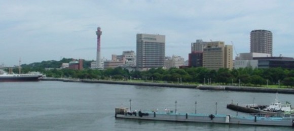
Scenery from the sea side
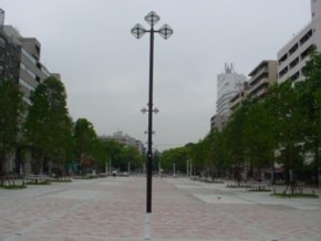
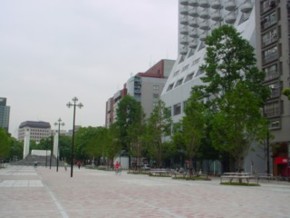
 Nihon Odori Avenue area
 Yamashita Park area
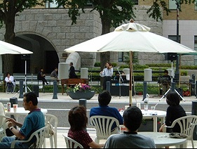
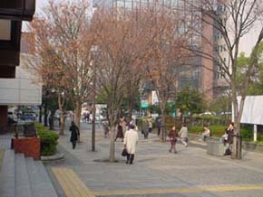
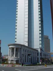
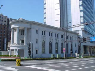
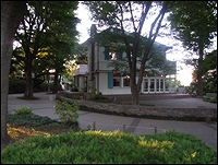
City Hall front district
Current status and issues and policies for community development
Located in the immediate vicinity of JR Kannai Station, this area is required to create a town that is in harmony with the greenery, city hall and Kusunoki Hiroba from Odori Park to Yokohama Park. As a gateway to Kannai-District, we aim to create a stately cityscape and a spacious space.
Business Overview
We establish scenery plan and scenery consultation district and perform prior consultation at the time of construction plan about wall retreat, building design.
Process
September 1959 Completed Yokohama City Hall (current Government Building)
Completed Kusunoki Hiroba Port Town in June 1974
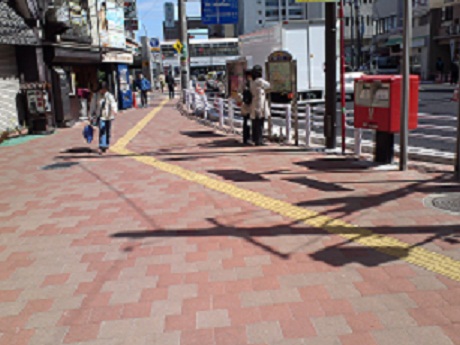
March 1985 Completed the JR Kannai Station South Exit Improvement Project
Barrier-free sidewalk from 2019 to 2012
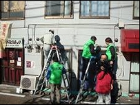
 In front of JR NEGISHI LINE Kannnai Sta.
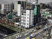
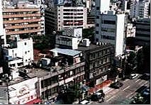
 Kusunoki Hiroba
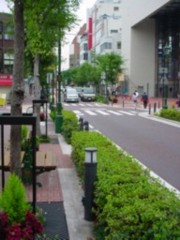
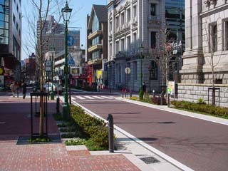
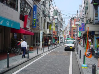
Basyamichi area
Current status and issues and policies for community development
Basyamichi is a place where various Western cultures have been introduced, such as street gas lights being lit for the first time in Japan, and many historical buildings are preserved and utilized, leaving a remnant of the history of opening the port.
In this area, Basyamichi Mall is required to strengthen commercial functions and createBasyamichi Town Development Agreement to create distinctive urban landscapes.
Business Overview
We establish scenery plan and scenery consultation district, city plan and perform prior consultation at the time of construction plan about wall retreat, building design.
Process
April 1975 Concluded the Basyamichi Avenue Community Development Agreement
Nov. 1976 Completed construction of Basyamichi Mall
Completed construction of the second phase of Basyamichi Mall in March 1978
March 1988 Completed the entrance to the Basyamichi Municipal Subway Kannai Station
April 1999 Completion of underground parking lot in Basyamichi
Completed the first phase of the redevelopment of Basyamichi Mall in March 2002
Completed the second phase of the redevelopment of Basyamichi Mall in March 2003
Minato Mirai Line Bashamichi Station opened in February 2004, completed underpass of Bashamichi Station
March 2008 City Planning Decision for Basyamichi District Planning
September 2008 Accredited the Basyamichi Community Development Agreement as a local community development rule
 Basyamichi District 1
 Basyamichi District 2
Kitanakadori district
Current status and issues and policies for community development
The Kitanakadori district is located at the junction between Minato Mirai 21 and Kannai-District, and is a district that actively guides business functions and promotes unique urban development by utilizing the creativity of local resources and cultural arts.
In January 2012, it was designated as a specific urban regeneration emergency maintenance area, and we will promote the introduction of attractive cultural and commercial functions and high-standard residential functions in the waterfront space.
Kitanakadori district town development guidelines (PDF: 2,348KB)
Business Overview
Kitanakadori Minami Area
We will strengthen our business functions through urban redevelopment projects. In the first section, Yokohama I Land Tower was completed in February 2003. The second construction zone was positioned as a planned site for the new city hall maintenance in March 2013.
New City Hall Maintenance Basic Design (move to General Affairs Bureau page)
a Name Kitanakadori Minami District Type 2 Urban Redevelopment Project
b Enforcement area Approximately 3.0 hectares each part of Kitanakadori, Naka-ku and Honmachi
c Enforcement The Urban Renaissance Agency
d Urban planning Kitanakadori Minami Area Redevelopment District Plan
Overview of Architecture
| Overview of Architecture | No. 1 Construction Zone | Second Construction Zone (planned) |
|---|---|---|
| Total floor area | Approx. 44,000 m2 | Approx. 164,000 m2 |
| Number of floors | 3rd basement floor, 27th floor above ground | 3 floors underground, 41 floors above ground |
| Height | Approx. 120m | Approx. 180m |
| Applications | Business, commercial and public facilities | Business and Commerce |
f Main public facilities
City Planning Road No. 3.1.7 Sakaehonmachi Line (width 40 meters, extension 160 meters), City Planning Road No. 3.3.1 Honmachi Line, Public Open Space (Broadside Line Promenade)
e Background
November 1990 City Planning Decision
November 1997 Change of city planning
Construction commenced in March 2000
Completed in February 2003
March 2008 The city acquired land in the second construction zone.
 Island tower 1
 Island tower 2
Kitanakadori North Area
As a new base to strengthen ties between Kannai-District and Minato Mirai 21 district, we are promoting urban development with the aim of guiding business and commercial functions, creating new creative cities centered on cultural arts, revitalizing the waterfront, creating urban landscapes by conservation such as Historic buildings and introducing residential functions.
a Name Kitanakadori North Land Readjustment Project
b Enforcement area Kaigandori, Naka-ku and Kitanakadori approximately 7.5 hectares
c District facility parks (approximately 500 square meters and 2 places, approximately 1,200 square meters), open space (approximately 11,000 square meters total area), border line promenade (approximately 6.0 meters extension approximately 420 meters wide)
d City planning Kitanakadori north redevelopment promotion district district planning
e Background
January 2000 Redevelopment Council was established by related right holders
May 2004 City planning decision of Kitanakadori Kita District District Planning
July 2007 Kitanakadori Kita District Precedence Block Environmental Assessment Examination Report
October 2007 Change of city planning of Kitanakadori north redevelopment promotion district city planning
December 2007 Approval of the establishment of Kitanakadori Kita Land Readjustment Association
January 2008 Construction started (land readjustment project)
January 2014 Notice of Landfill Disposal (January 24, 2014)
March 2015 Public facilities management handover
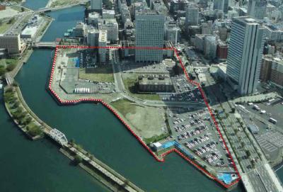
Kitanakadori North Area
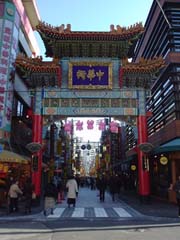
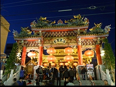
Chinatown area
Current status and issues and policies for community development
Yokohama-Chinatown, which preserves traditional culture and promotes unique urban development, is still popular as an attractive city with rich Chinese atmosphere and attracts many people from overseas as well as Japan.
On the other hand, issues such as illegal bicycle parking and business nuisance have occurred, so the local community has organized a town planning council to establish a city planning agreement, inheriting Chinese culture, forming a unique cityscape landscape, We will promote attractive city planning.
Business Overview
We establish scenery plan and scenery discussion district and perform prior consultation at the time of construction plan about building design.
Process
August 1990 Reconstruction of the Kantei Shrine
January 1993 Established the Yokohama-Chinatown Association of Urban Development Organizations
Completed the Chinatown Charter in May 1995
August 1995 Completion of Kowloon Display Window at Yamashitacho Public Parking Lot
March 1998 Completed the public toilet "Wootei"
Completed Yamashita-Cho Koen Kaihotei in June 2000
February 2003 Completed the Chaoyangmon tilehouse
Completed renovation of East Gate Street in January 2004
February 2004 Opened Minato Mirai Line Motomachi-Chukagai Station
Completed redevelopment of Chukagai-Odori(Chinatown Main Street) in June 2005
Completed in March 2006 in Yokohama Masobyo
October 2006 Concluded the Yokohama-Chinatown Community Development Agreement
Chinatown District 1
Chinatown District 2
Chinatown District 3
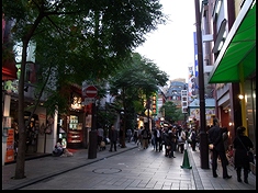
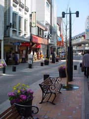
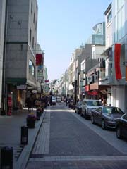
Motomachi area
Current status and issues and policies for community development
With the opening of Yokohama, this area has developed as a shopping street used by foreign residents, and is a representative shopping street in Yokohama, which has spread sophisticated Yokohama fashion throughout the country. In order to create a comfortable pedestrian space, we maintain malls on the street and carry out town development throughout the district. The Motomachi City Development Agreement, the Motomachi Naka Dori District Town Development Agreement, and the Motomachi Street Town Development Agreement have been established, and the local community is taking the initiative in promoting unique urban development.
Business Overview
We establish scenery plan and scenery consultation district, city plan and perform prior consultation at the time of construction plan about building use, wall retreat, building design.
Process
November 1955 Designated wall line (Motomachi Street)
August 1985 Concluded the Motomachi Community Development Agreement
Completed Motomachi Mall in August 1985
January 1999 Motomachi Naka Dori Streetscape Induction District Planning
May 1999 Concluded the Motomachi Naka Dori District Community Development Agreement
May 2002 Established the Motomachi Charter for Town Development
January 2003 City Planning Decision for Motomachi District Planning
Completed redevelopment of Motomachi Street in January 2004 (Square maintenance, etc.)
Motomachi Town Development Agreement, Motomachi Street Town Development Agreement, Motomachi Naka Dori District Town Development Agreement
February 2004 Opened Minato Mirai Line Motomachi-Chukagai Station
Completed redevelopment of Motomachi Nakadori in March 2006
September 2009 Motomachi Town Development Agreement, Motomachi Naka Dori District Town Development Agreement and Motomachi Street Town Development Agreement were certified as rules for community development.
January 2020 Started operation of the landscape plan and the cityscape consultation district
Motomachi District 1
Motomachi District 2
Motomachi District 3
Yamate-District
Current status and issues and policies for community development
Yamate Hill has many Western-style buildings and greenery as former foreign settlements. In order to preserve the scenic beauty of the Yamate-District, which retains the remnants of foreign settlements, and to secure the view of the urban area from Yamate-District, we will support local residents' enthusiastic community development activities.
Business Overview
We establish scenery plan and scenery discussion district, city plan and perform prior consultation at the time of construction plan about form or use of building.
Process
June 1970 Enforcement of the Scenic Area Ordinance
November 1972 Yamate-District Scenic Beauty Conservation Guidelines
April 1988 Established town development guidelines that make use of history
September 1998 Established Yamate Town Development Charter
Established Yamate Town Development Promotion Council in June 2002
October 2004 Urban Planning Decision for Yamatecho District Planning
February 2005 Concluded a Yamate Town Development Agreement
April 2008 Certified Yokohama-Yamate-District Community Development Plan 2007 as a Community Development Plan
September 2011 Certified "Yamate Town Development Agreement" as a local town development rule
February 2015 Urban planning decision for the western part of Yamatecho Bunkyo District District Planning
January 2020 Started operation of the landscape plan and the cityscape consultation district
 Yamate-District 1
 Yamate-District 2
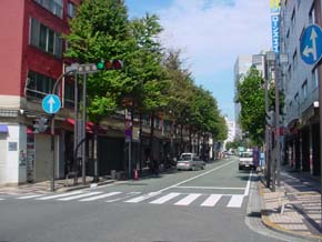
Ishikawa-machi area
Current status and issues and policies for community development
This area is the closest station to Yokohama's leading tourist destinations such as Yamashita Park, Chinatown, and Yamate. Therefore, we will promote unique town development suitable for the starting point of the city center promenade, such as securing pedestrian space by retreating the walls of buildings and redevelopment of sidewalks in shopping streets.
Business Overview
We establish scenery plan and scenery consultation district and perform prior consultation at the time of construction plan about securing of pedestrian space by wall retreat of building, use of building, design of building.
Process
Completion of Urban Promenade Project in 1976 (1.2 km)
July 1977 Designation of wall line (Ishikawa-cho)
Completed development of the East Exit Ishikawacho Station in 2001, opened the Chinatown Exit of JR Ishikawacho Station.
2007-Study sessions to secure pedestrian spaces
November 2011 Consideration of rule creation at Ishikawa Shopping Street
December 2011 Certification of the Regional Shopping Street Activation Act
March 2013 Completion of road surface maintenance by Ishikawa shopping street environment improvement project
January 2020 Started operation of the landscape plan and the cityscape consultation district
Ishikawa-machi area
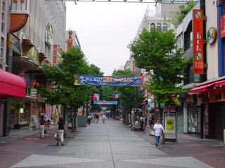
Isezakicho area
Current status and issues and policies for community development
Since the opening of the port, this area has been nicknamed "Zaki" as one of the representative shopping streets in the city center. In recent years, the entry of customs business stores has become an issue in some areas, and local communities have established and operated the “Town Development Charter” and “Town Development Agreement” that specify restrictions on uses and forms for buildings facing malls. doing. Going forward, we will continue to work with the local community to revitalize shopping streets and create a good urban space.
Business Overview
In addition to establishing a city plan in the Isesaki 1 and 2-chome districts, operating restrictions on the use of buildings facing the mall, etc., designated as a town planning consultation district, building use and securing pedestrian space, etc. Prior consultation is held at the time of planning. (→ Isezakicho District Town Planning Council Guidelines)
Process
November 1978 1-2-chome Mall Open
April 1982 Conclusion of 1.2-chome district town planning agreement
November 1982 3-4-Chome Mall Open
April 1985 Conclusion of 3.4-chome district town planning agreement
November 1991 5.6-Chome Mall Open
April 7, 1994 Mall Open
November 1999 Completed the completion of the welcome gate
November 2000 Completed maintenance of the Passage Mall, etc.
Dec. 2005 City Planning Decision for Isezakicho 1, 2-chome District Planning
March 2010 Isesaki Club “Cross Street” opened
 Isezakicho District 1
 Isezakicho District 2
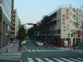
Yoshida-cho area
Current status and issues and policies for community development
Kittacho Street, located between the Isezakicho and Noge districts, is located in the center of the district, has been a historically historic street since the opening of the port.
Town development that makes use of tradition is required, and we aim to create an attractive cityscape by securing pedestrian spaces by retreating walls.
Business Overview
We designate as town planning consultation district and perform prior consultation at the time of construction plan about communalization and use of building, securing of pedestrian space. (→ Yoshida-cho district town planning consultation guidelines)
Process
May 1987 Conclusion of Yoshida-cho district town planning agreement
September 1988 Completed the Yoshidacho-dori Environmental Improvement Project
 Yoshida-cho district 1
 Yoshida-cho district 2
Noge district
Current status and issues and policies for community development
In response to the closure of the Toukyu Toyoko Line line between Yokohama and Sakuragicho following the opening of Minato Mirai Line, we have taken various measures such as improving the pedestrian environment and supporting Noge street performance to promote the district.
Based on the district characteristics that have been popular with citizens as a common and popular town, along with town development from the viewpoint of cooperation with the Minato Mirai 21 district, town development utilizing the uniqueness of Noge is required, and with the local community, We will continue to consider various revitalization measures. .
Peripheral map of Noge area
Business Overview
Designated as a town planning consultation district, we conduct prior consultation on building use, wall retreat, building design, etc. at the time of construction planning. (→ Noge District Town Planning Consultation Guidelines)
In addition, in order to strengthen the excursion, we will promote the sidewalk widening maintenance project on prefectural roads between JR Sakuragicho Station and Keikyu Hinodecho Station.
Process
In 1987, mutual direct operation between Minato Mirai Line and Toukyu Toyoko Line and the resulting decision on the abolition of the lines between Yokohama and Sakuragicho
April 1988 Conclusion of a “Memorandum / Confirmation Form on Minato Mirai 21 Line and District Promotion” by a local town development organization “Noge District Town Planning Association” and Yokohama City and Tokyu Corporation.
June, 1988
~ November “Maintenance Promotion Liaison Council” was established in Noge, Tobe, and Takashima areas
March 1990 Completion of pedestrian environment improvement project in Noge Hon Dori (Nogezaka)
November 1990 Launched “Public Trust in Yokohama Noge District Town Development Trust”
March, 1993
-January 2009 Implemented a pedestrian environment improvement project on eight streets, including Noge Sakura-dori St.
November 1996 Nogecho 3-chome North District Type 1 Urban Redevelopment Project City Planning Decision
April 1999 Sakuragicho-sta. underground passage “Noge Chikamichi” commenced operation
December 2001 3-chome Nogecho North District Type 1 Urban Redevelopment Project Facility Building Shunko
April 2002 Opened the Yokohama Nigiwai-za entertainment center
April 2002 100 yen bus "Hinodecho Station Route" started operation
March 2009 Completion of maintenance projects such as excellent buildings in the Hanasaki 1-chome district
Opened Noge Hana Hana, a local joint facility
September 2011 Review of 100 yen bus operation method
Complete repair of Noge Chuo Dori in March 2012
Completed renovation of the Sakuragicho Underpass in March 2012
August 2012 Construction of sidewalk widening maintenance on prefectural roads between Sakuragicho and Hinodecho commenced (H24-H26)
Noge district
Area around Hinodecho Station
Current status and issues and policies for community development
Keikyu Hinodecho Station is located close to Sakuragicho and Isezakicho, as well as the nearest stations to Nogeyama Park and Chuo-toshokan.
At present, aging buildings, parking lots, vacant lots, etc. are mixed around the station, and there are many issues such as the lack of efficient land use as a station square area. From the viewpoint of fire prevention and disaster prevention, Hinodecho Station A communal building in the south exit area has been developed. In addition, urban redevelopment projects are being promoted in the Hinodecho Ekimae A district, and we will continue to aim for non-combustible buildings around the station, advanced use of land, and lively creation.
Business Overview
In the Hinodecho Ekimae A District Urban Redevelopment Project, the establishment of a redevelopment union was approved in January 2011, and the business is aimed at forming a living base for local residents by maintaining complex buildings such as commerce, business, and housing facilities Is being promoted.
(a) Name Hinodecho Ekimae A District Urban Redevelopment Project
(b) Enforcement area Approximately 0.7 hectares outside 1-51 Hinode-cho, Naka-ku
(c) District facility sidewalk-like open space, pedestrian-only road, open space
(d) Enforcer Hinodecho Ekimae A District Urban Redevelopment Association
(o) 21 floors above ground, commercial services, paid nursing homes, apartment and others
Process
August 1997 Established Hinodecho Ekimae A District Urban Redevelopment Preparatory Association
October 2008 Hinodecho Ekimae A District Type 1 Urban Redevelopment Project City Planning Decision (Hinodecho Ekimae A District Planning)
January 2011 Hinodecho Ekimae A District Urban Redevelopment Association establishment approval
February 2012 Hinodecho Ekimae A District Urban Redevelopment Project Right Conversion Plan Approval
 Area around Hinodecho Station 1
 Area around Hinodecho Station 2
First Yellow and Hinodecho district
Current status and issues and policies for community development
Until now, the environmental degradation due to illegal business of some stores has been a major problem in this area, but with the cooperation of the local, police, and the government, we aim to transform it into a healthy city where everyone can walk with peace of mind. Currently, we are working on various environmental improvements, and we aim to create a bright and livable city in the future.
Business Overview
We designate as town development consultation district and perform prior consultation at the time of construction plan about building use, wall retreat. In addition, in order to revitalize the district, we will promote the borrowing of closed small stores, renovate internally so that cultural and artistic activities etc. can be established, lend it to artists, etc., and utilize it under the Keikyu elevated We will consider.
Process
November 2003 Established the "First Yellow Hinodecho Environmental Purification Promotion Council"
Started operations by Kanagawa Police Headquarters in January 2005 (Eradication of prostitution restaurants)
July 2005 Established the “First Yellow / Hinodecho Environmental Purification Promotion Council Town Development Promotion Subcommittee”
August 2007 Formulated the "First Yellow / Hinodecho District Town Planning Consultation Guidelines"
September 2008 “Koganecho-November Bazaar” was held using small-scale stores under the Keikyu viaduct (held continuously every year thereafter)
April 2009 Established the Koganecho Area Management Center, a non-profit organization.
August 2011 Kaidan Plaza maintenance
March 2012 Kogane studio square maintenance
 First yellow, Hinodecho district 1
 First yellow, Hinodecho district 2
Odori Park area
Current status and issues and policies for community development
This area is centered around Odori Park, and there is a need for urban development in harmony with the greenery of the park.
In addition, in order to realize comfortable living in the city center, we will guide a well-balanced location between housing and commercial and business facilities with the goal of creating a green city and creating a comfortable complex urban area.
Business Overview
Designated as a town planning consultation district, prior consultation is held at the time of construction planning on communalization of the site, securing of pedestrian space, building use, harmony of cityscape, promotion of greening, etc. (→ Odori Park Area Community Development Council Guidelines)
Process
August 1973 Designation of wall lines on both sides of Odori Park residential land
Established Odori Park in September 1978
Completed the redevelopment of Odori Park in March 2000
Completed redevelopment of Odori Park in March 2003
April 2003 Completed the municipal Isezaki-Chojamachi underground parking lot
 Odori Park area
 Area around the main street 2
You may need a separate PDF reader to open a PDF file.
If you do not have it, you can download it free of charge from Adobe.
![]() To download Adobe Acrobat Reader DC
To download Adobe Acrobat Reader DC
Inquiries to this page
Urban Revitalization Division, Urban Development Bureau Metropolitan Revitalization Promotion Department
Phone: 045-671-3782
Phone: 045-671-3782
Fax: 045-664-3551
E-Mail address tb-tosai@city.yokohama.lg.jp
Page ID: 562-914-219


