


- Yokohama-shi Top Page
- Living, procedures
- Community Development and Environment
- Urban Development
- Methods for Urban Development
- Land readjustment project
- List of land readjustment project enforcement districts
The text is from here.
List of land readjustment project enforcement districts
Last updated on November 1, 2024.
●This list publishes an overview of the land readjustment project implemented in Yokohama City.
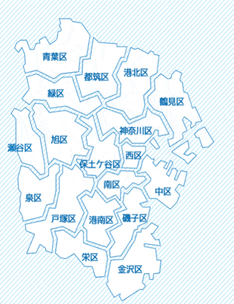
In addition, we can confirm business enforcement area in Yokohama-shi city area development business enforcement district position figure (PDF: 16,093KB) (updated in 2023).
●We can confirm in list (PDF: 43KB) such as the number of land readjustment projects that we carried out in Yokohama-shi.
●Unlike the land area survey map, the land lot confirmation map (replacement map) is the final map at the time of the land lot disposal. It may differ from the current situation.
●Because there is no obligation to submit the resettlement map (replacement map) to the city, there are some drawings that the city does not own.
About drawing which had you offer arbitrarily from enforcer, we publish in Yokohama-shi substitute lot confirmation figure reading system "Kukapo".
Please check "Yes / No" in the column of the replacement map in this list.
●In areas where the resettlement map (replacement map) is "Yes", you can check and print with the Yokohama-shi resettlement map reading system "Kukapo".
In addition, we can read and copy (pay) in citizen information center (city hall the third floor).
●Please contact Green Environment Bureau Agricultural Policy Promotion Division for land replacement under the Land Improvement Act.
●When we change trait of land, new construction, remodeling or extension of building or other structures in business area,
Permission under Article 76 of the Land Readjustment Act is required.
※If one area spans multiple wards, it is posted only in a ward with a large area. ※About 2 Areas ・Ward, town name may be changed by ward reorganization or house indication. Please confirm in conjunction with Yokohama-shi city area development business enforcement district location map (PDF: 16,093KB) (updated in 2023) and present situation map. ・Some towns cover multiple business areas. ※3 groups: Union City: Yokohama City U: UR (Urban Renaissance Agency) Individual: Individual: Republic of Korea: Country: Administrative agency |
|||||||
|---|---|---|---|---|---|---|---|
Ward (* 1) |
Business name | Area(*2) |
Area (ha) |
Enforcer |
Business approval |
Landfill disposal Date of public notice |
Replacement map |
Green leaves |
Akata | Azamino 2-chome, Azamino 3-chome, Azamino Minami 1-chome, Azamino Minami 2-chome, Azamino Minami 3-chome, Azamino Minami 4-chome, Eda Kita 3-chome, Shinishikawa 1-chome and a part of Misuzugaoka | 68.8 | Group | S60.01.14 | H04.09.05 | Yes |
| Ikejiri | Part of Edacho | 3.1 | Group | S53.10.07 | S56.09.25 | Yes | |
| Tamukai, Izumi | Part of Ichigaocho, Eda Nishi 3-chome, Eda Nishi 4-chome and Eda Nishi 5-chome |
46.4 | Group | S54.01.25 | S58.09.24 | Yes | |
| Ichigao Kawawa | Part of Ichigaocho, Eda Nishi 3-chome, Eda Nishi 4-chome and Eda Nishi 5-chome |
47.2 | Group | S50.11.15 | S54.06.23 | Yes | |
| Ichigao Daiichi | Part of Ichigaocho, Eda Kita 2-chome and Eda Nishi 1-chome | 28.9 | Group | S38.09.14 | S43.05.04 | Yes | |
| Ichigao Daini | Part of Ichigaocho | 9.1 | Group | S52.06.15 | S55.07.05 | Yes | |
| Ekoda | Part of Egoda 1-chome, Egoda 2-chome, Egoda 3-chome, Susukino 1-chome, Susukino 3-chome and Motoishikawacho | 67.5 | Group | S52.11.15 | S59.04.28 | No | |
| Eda Daiichi | Part of Edacho | 29.7 | Group | S36.06.10 | S43.08.05 | Yes | |
| Daiba Daiichi | Part of Oba-cho, Kurosuda and Misuzugaoka | 40.0 | Group | S58.01.14 | H01.07.15 |
No | |
| Daiba Daini | Azamino 3-chome, Ichigaocho and a part of Misuzugaoka | 11.2 | Group | H02.04.14 | H07.03.15 | Yes | |
| Daiba Third | Part of Oba Town | 3.6 | Group | H02.04.14 | H05.09.24 | Yes | |
| Daiba Daishi | Part of Oba-cho and Misuzugaoka | 1.6 | Group | H30.09.05 | R04.11.15 | Yes | |
| Onda Daiichi | Aobadai 1-chome, Enokigaoka, Shiratoridai Tsutsujigaoka and a part of Fujigaoka 2-chome | 27.4 | Group | S36.04.01 | S39.03.30 | Yes | |
| Onda Daini | Aobadai 1-chome, Aobadai 2-chome, Enokigaoka, Katsuradai 1-chome, Sakuradai, Tachibanadai 2-chome, Shofuudai, Mitakedai, Moegino and a part of Wakakusadai | 172.9 | Group | S37.04.14 | S42.05.04 | Yes | |
| Onda Third | Part of Enokigaoka, Satsukigaoka, Shiratoridai, Tanacho and Tsutsujigaoka | 65.0 | Group | S38.06.15 | S42.11.15 | Yes | |
| Onda 4th | Part of Enokigaoka, Tanacho and Shofudai | 54.8 | Group | S40.09.25 | S46.03.25 | Yes | |
| Onda No. 5 | Part of Ondacho, Katsuradai 1-chome, Katsuradai 2-chome, Shofuudai and Wakakusadai | 90.5 | Group | S47.08.15 | S57.01.09 | Yes | |
| Kamionda | Akanedai 1-chome, Akanedai 2-chome and a part of Ondacho | 58.3 | Group | S58.07.25 | H02.02.17 | No | |
| Kami-Tanimoto Daiichi | Part of Kakinokidai, Sakuradai, Fujigaoka 1-chome, Fujigaoka 2-chome, Mitakedai and Moegino | 53.1 | Group | S42.03.25 | S46.01.14 | Yes | |
| Kami-Tanimoto Daini | Part of Kakinokidai and Moegino | 29.2 | Group | S45.12.25 | S49.09.25 | Yes | |
| Kamitanimoto No. 3 | Part of Kakinokidai and Mitakedai | 43.8 | Group | S46.07.05 | S50.09.27 | Yes | |
| Kamoshida | Part of Kamoshidacho | 55.9 | U | S48.03.31 | S55.03.28 | No | |
| Kamoshida No. 2 | A part of Kamoshidacho, Tachibanadai 2-chome and Wakabadai | 16.2 | Group | S48.06.15 | S52.02.25 | Yes | |
| Kurosuda | Part of Oba Town and Kurosuda | 23.8 | Group | S58.01.14 | H03.08.24 | No | |
| Kenzan Daiichi | Biyugaoka Nishi 3-chome, Ekoda 2-chome, Kuroganecho, Kurosuda, Susukino 1-chome, Susukino 2-chome, Susukino 3-chome and a part of Mominokidai | 90.4 | Group | S46.02.25 | S48.10.25 | Yes | |
| Kenzan No. 2 | Part of Egoda 3-chome, Oba-cho, Kurosuda, Susukino 1-chome and Motoishikawacho | 29.7 | Group | S46.02.25 | S49.09.14 | Yes | |
| Oguro | Azamino Minami 3-chome, Eda Kita 1-chome, Eda Kita 2-chome and part of Eda Kita 3-chome | 43.9 | Group | S48.08.15 | S53.04.28 | Yes | |
| Shimo-Ichigao Daiichi | Part of Ichigaocho and Eda Nishi 1-chome | 21.9 | Group | S42.04.05 | S44.06.25 | Yes | |
| Shimotanimoto Daini | A part of Umegaoka, Chigusadai, Fujigaoka 1-chome and Fujigaoka 2-chome | 64.0 | Group | S39.06.25 | S43.08.05 | Yes | |
| Shimotanimoto Nishi hassaku | Umegaoka, Kakinokidai, Tsutsujigaoka, Fujigaoka 1-chome, Fujigaoka 2-chome and part of Moegino | 104.5 | Group | S37.04.14 | S41.11.05 | Yes | |
| Nara | All of Hajime Nara chome, Nara 2-chome, Nara 3-chome, Nara 4-chome and Nara 5-chome | 87.6 | U | S58.01.24 | H08.09.29 | Yes | |
| Nara Onda | Part of Ondacho, Katsuradai 2-chome and Sumiyoshidai | 49.1 | Group | S46.03.05 | S51.07.15 | Yes | |
| Nareai | A part of Kamoshidacho, Tachibanadai 1-chome and Tachibanadai 2-chome | 59.6 | Group | S42.05.04 | S46.01.25 | Yes | |
| Second West hassaku | Part of Umegaoka, Satsukigaoka and Chigusadai | 51.5 | Group | S42.01.25 | S45.02.25 | Yes | |
| Fujizuka | Part of Eda Nishi 1-chome, Eda Nishi 2-chome and Eda Nishi 3-chome | 47.7 | Group | S53.10.07 | S58.09.10 | No | |
| Hoki | Biyugaoka Nishi 1-chome, Biyugaoka Nishi 2-chome, Biyugaoka Nishi 3-chome, Ekoda 2-chome and part of Motoishikawacho | 97.8 | Group | S53.06.15 | H01.11.04 | No | |
| Motoishikawa Daiba | Azamino 1-chome, Azamino 2-chome, Azamino 3-chome, Azamino 4-chome, Azamino Minami 3-chome, Bibigaoka 5-chome, Obacho, Shinishikawa 1-chome and a part of Motoishikawacho | 179.7 | Group | S44.06.05 | S51.01.14 | Yes | |
| Motoishikawa Daiichi | A part of Biyugaoka 1-chome, Biyugaoka 2-chome, Biyugaoka 3-chome, Biyugaoka 4-chome, Biyugaoka 5-chome, Shinishikawa 1-chome and Shinishikawa 3-chome | 118.0 | Group | S38.03.15 | S44.01.14 | Yes | |
| Motoishikawa No. 2 | Azamino 1-chome, Azamino 4-chome, Biyugaoka 1-chome, Biyugaoka 3-chome, Biyugaoka 4-chome, Biyugaoka 5-chome, Shinishikawa 1-chome and a part of Motoishikawacho | 94.8 | Group | S42.05.04 | S47.07.25 | No | |
| Motoishikawa Third | Part of Edacho, Shin-Ishikawa 1-chome, Shin-Ishikawa 2-chome, Shin-Ishikawa 3-chome and Shin-Ishikawa 4-chome | 87.7 | Group | S47.06.05 | S54.02.17 | Yes | |
Asahi |
Kashiwa | Part of Kashiwacho | 31.8 | Group | S47.08.05 | S54.06.25 | Yes |
| Wakabadai | All of Wakabadai 1-chome, Wakabadai 2-chome, Wakabadai 3-chome and Wakabadai 4-chome |
89.7 | Cohort | S53.10.14 | S54.02.24 | No | |
Spring |
Izumi | Part of Izumi-cho (in order of residence indication) | 42.3 | Group | S47.08.05 | S51.10.05 | Yes |
| Izumichuo | Izumi-cho (in order of residence indication) and a part of Izumi Chuo Minami 5-chome | 3.7 | Group | H12.12.25 | H15.05.02 | Yes | |
| Yumegaoka, Izumi | Yumegaoka (change of street name in September 2024) |
23.9 | Group | H26.08.15 | R06.09.01 | Yes | |
| Okazu | Part of Okazu-cho | 6.0 | Group | S63.09.05 | H04.09.05 | Yes | |
| Shimbashi | All of Yayoidai | 35.9 | Group | S49.04.05 | S55.01.25 | Yes | |
| Shimbashi Enoki Bridge | Part of Shimbashi Town | 1.0 | Group | H21.08.25 | H24.07.25 | No | |
| Shimbashi Junreizaka | Part of Shimbashi Town | 2.8 | Group | H11.08.05 | H15.03.05 | Yes | |
| Shimbashi Yatsutsuka | Part of Shimbashi Town | 5.6 | Cohort | S48.11.05 | S49.03.05 | No | |
| Position South | Part of Nakata Nishi 1-chome | 3.6 | Group | H14.01.15 | H16.10.05 | Yes | |
| Nakadamachi, Totsuka | A part of Minami Nakata 2-chome and Minami Nakata 3-chome | 7.2 | Cohort | S18.12.10 | S21.07.04 | No | |
| Nakagawa Daiichi | All of Midorien 1-chome, Midorien 2-chome, Midorien 3-chome, Midorien 4-chome, Midorien 5-chome, Midorien 6-chome and Midorien 7-chome |
122.3 | Group | S49.11.05 | S61.04.05 | Yes | |
| Nishida | Part of Okazu-cho, Katsurazaka, Shirayuri 3-chome, Shimbashi-cho, Nakata-Nishi 4-chome, Nishigaoka 1-chome, Nishigaoka 2-chome and Nishigaoka 3-chome | 48.9 | Group | S57.11.25 | S63.01.09 | No | |
| Nishida Daini | Part of Katsurazaka and Nishigaoka 2-chome | 8.0 | Group | H03.11.25 | H07.06.05 | Yes | |
| Mt. Hyuga | Izumi-cho (in order of residence indication) and a part of Kami-Iida-cho |
35.3 | Group | S47.08.05 | S51.09.14 | Yes | |
| Miyako | Part of Okazu-cho and Shimbashi-cho | 8.2 | Group | H03.08.15 | H08.01.12 | Yes | |
| A royal family | A part of Okazu-cho, Shirayuri 1-chome, Ryoke 1-chome, Ryoke 2-chome, Ryoke 3-chome and Ryoke 4-chome | 38.6 | Group | S57.11.25 | S63.01.09 | Yes | |
| Ryoke No. 2 | Part of Okazu-cho | 4.2 | Group | H07.08.04 | H11.05.25 | Yes | |
Isogo |
Kaminakazato | Part of Kaminakazato Town and Hitorizawa Town | 15.6 | Individual | S47.05.04 | S49.04.15 | No |
| Shiomidai | Part of Okamura 8-chome and Shiomidai |
72.8 | Individual | S37.11.05 | S38.06.25 | No | |
| Left right hand | Part of Tanaka 2-chome | 2.1 | Cohort | S44.06.05 | S48.08.04 | Yes | |
| Maruyama-cho | Part of Maruyama 1-chome | 6.0 | Group | S10.03.19 | S13.12.09 | Yes | |
| Yokodai | A part of Tanaka 2-chome, Yokodai 1-chome, Yokodai 2-chome, Yokodai 3-chome, Yokodai 4-chome, Yokodai 5-chome and Yokodai 6-chome |
207.5 | U | S41.10.01 | S48.08.07 | No | |
Kanagawa |
Uchikoshi | Part of Koyasudai 1-chome, Koyasudai 2-chome and Shinkoyasu 1-chome |
10.2 | Group | S09.01.19 | S29.03.16 | Yes |
| Large mouth | A part of Oguchi-dori and Oguchi-Nakamachi | 8.1 | Group | S05.09.05 | S07.08.12 | No | |
| Oguchi (First Construction Zone) | Part of Oguchi-dori, Oguchi-Nakacho, Nanashima-cho and Nishioguchi | 21.4 | Line | S22.12.18 | S34.11.05 | Yes | |
| Large-scale (Second Construction Zone) | Part of Matsumicho | 24.8 | Line | S32.04.05 | S38.10.15 | Yes | |
| Katakura Agricultural and Housing Association | Part of Katakura 5-chome | 1.5 | Individual | H13.04.05 | H16.07.05 | Yes | |
| 2, Hazawaminami, Kanagawa | A part of Hazawa Minami 2-chome and Hazawa Town | 1.5 | Individual | H28.01.25 | R02.12.04 | Yes | |
| Kaminogi | Part of Irie 2-chome, Kaminogi-cho and Kaminokidai | 9.2 | Group | S10.07.16 | S30.04.08 | Yes | |
| Kougaya | A part of Aokicho, Onocho, Kanagawa 1-chome, Kanagawa 2-chome, Kanako-cho, Kougaya and Sakaemachi | 48.6 | Line | S22.06.05 | S53.02.04 | Yes | |
| Koyasu | Part of Irie 1-chome, Irie 2-chome, Kaminogi-cho, Koyasu-dori and Shinkoyasu 1-chome | 47.2 | Line | S24.02.03 | S43.09.14 | Yes | |
| In front of Shinkoyasu Station | Part of Koyasu-dori | 1.0 | Cohort | S26.11.13 | S28.07.17 | Yes | |
| Daimachi | Part of Izumicho, Sawando, Daimachi, Takashimadai and Tsuruyacho | 41.3 | Line | S24.02.03 | S49.02.05 | Yes | |
| Tammachi | Izumicho, Kamitanmachi-cho, Kiribatake, Tammachi, Matsugaoka, Matsumotocho, Mitsuzawashimomachi and part of Mitsuzawanakamachi | 48.7 | Line | S23.12.16 | S36.02.15 | Yes | |
| Nishi-Kannagawa | Asahigaoka, Saitobunchou, Tachimachi, Tomiyacho, Torigoe, Nishikannagawa 1-chome, Nishikannagawa 2-chome, Nishikannagawa 3-chome, Hakuraku, Hirakawacho, Hirodai-Otacho and a part of Futatsuyacho | 57.0 | Line | S23.12.16 | S53.09.09 | Yes | |
| Nishiterao | Part of Nishi-Terao 1-chome, Nishi-Terao 2-chome and Nishi-Terao 3-chome | 17.8 | Group | S10.10.15 | S33.08.19 | Yes | |
| Azumacho, Nishiterao | Part of Nishi-Terao 2-chome, Nishi-Terao 3-chome and Nishi-Terao 4-chome | 9.8 | Group | S38.04.25 | S46.08.25 | Yes | |
| Higashikanagawa | Urashimacho, Kanagawa 2-chome, Kanagawa Honmachi, Kamezumicho, Koyasu-dori, Shinmachi, Higashi-Kanagawa 1-chome and a part of Higashi-Kanagawa 2-chome | 42.8 | Line | S24.02.03 | S51.01.17 | Yes | |
| North of Higashi Takashima Station | Part of Kanagawa 1-chome, Kanagawa 2-chome, Chiwaka-cho and Hoshinocho | 7.5 | Group | H30.06.15 | In business | - | |
| Miyamen | Part of Nakamaru, Rokukakubashi 2-chome, Rokukakubashi 3-chome, Rokukakubashi 4-chome and Rokukakubashi 5-chome | 18.0 | Group | S09.03.02 | S12.04.02 | No | |
| Around the Yamauchi Wharf | Part of Hashimoto-cho and Hoshinocho | 7.1 | Group | H15.03.25 | H18.07.14 | Yes | |
| Rokukakubashi | Part of Rokkakubashi 1-chome | 5.0 | Group | S04.03.15 | S06.10.16 | Yes | |
Kanazawa |
A street | A part of Daido 1-chome, Daido 2-chome and Higashi-Ahina 3-chome | 9.0 | Group | S37.09.25 | S41.01.25 | Yes |
Kanazawa Hakkei Station East Exit (PDF: 257KB) |
A part of Seto | 2.4 | City | S61.12.05 | H31.02.11 | Yes | |
| Three boats | Part of Rokuura Minami 2-chome and Rokuura Minami 4-chome | 6.8 | Individual | S19.05.11 | S23.11.25 | No | |
| Yatsu | Part of Yatsu-cho | 2.6 | Group | S14.05.23 | S18.04.02 | No | |
Kohoku |
Okurayama | Okurayama 2-chome, Okurayama 3-chome, Osone 1-chome, Osone 2-chome, Osone 3-chome and part of Osonedai | 33.4 | Group | S15.04.30 | s35.03.18 | Yes |
| Mt. | Part of Shinoharadai-cho | 6.4 | Group | S05.06.06 | S07.06.17 | No | |
| Around Shin-Tsunashima Station | Part of Tsunashima Higashi 1-chome and Tsunashima Higashi 2-chome | 2.7 | City | H29.02.15 | In business | - | |
| Northern Shin-Yokohama Station | Shin-Yokohama 1-chome, Shin-Yokohama 2-chome and Shin-Yokohama 3-chome | 80.5 | Line | S40.08.25 | S50.11.05 | Yes | |
| Part of Kita-Shin-Yokohama 1-chome and Kita-Shin-Yokohama 2-chome | 13.2 | City | H08.12.25 | H17.01.30 | Yes | ||
| Takada Daiichi | Part of Shimodacho 5-chome, Takada Higashi 2-chome and Takada Higashi 3-chome | 9.8 | Group | S41.12.24 | S47.05.25 | Yes | |
| Myorenjidai | Part of Kikuna 2-chome and Nakatehara 1-chome | 5.3 | Individual | S18.12.10 | S19.11.16 | No | |
| Morito Hara | Part of Takada Higashi 2-chome, Hiyoshi Honmachi 5-chome and Hiyoshi Honmachi 6-chome | 9.8 | Group | S48.08.04 | S52.03.05 | No | |
Konan |
Kamiooka | Part of Kami-Ooka Nishi 3-chome | 7.9 | Individual | S19.07.13 | S22.02.13 | No |
| Konandai | Konandai 1-chome, Konandai 2-chome, Konandai 3-chome, Konandai 4-chome, Konandai 5-chome, Konandai 6-chome, Konandai 7-chome, Konandai 8-chome, Konandai 9-chome and Hino Minami 1-chome Part of | 298.6 | U | S44.09.08 | S57.03.13 | No | |
| Minamimaruyama, Minato | Part of Maruyamadai 1-chome, Maruyamadai 2-chome, Maruyamadai 3-chome and Maruyamadai 4-chome | 66.7 | Group | S46.11.25 | S55.10.18 | No | |
| Noba | Part of Nobacho, Hino 7-chome, Hino 8-chome and Hino 9-chome | 97.0 | Cohort | S47.11.15 | S52.03.05 | No | |
| Hino | Part of Hino Chuo 2-chome, Konan-ku |
5.1 | Group | H07.04.25 | H11.03.25 | Yes | |
Sakae |
Kosugaya | Part of Kosugegaya 4-chome and Hongodai 1-chome | 2.6 | Group | H13.04.25 | H16.11.25 | Yes |
| Nagaodai | Part of Nagaodai-cho | 4.2 | Group | H07.05.25 | H10.11.25 | Yes | |
Seya |
Akuwa | A part of Akuwa Nishi 2-chome, Akuwa Higashi 2-chome and Akuwa Higashi 4-chome | 4.1 | Group | H06.12.22 | H10.05.15 | Yes |
| Former Kamiseya Communication Facility | A part of Kamiseya-cho, Kitamachi, Seyacho and Nakayashiki 3-chome, Seya-ku |
248.5 | City | R04.10.05 | In business | - | |
| Shimoseya | Part of Kitashin, Shimoseya 3-chome and Hashido 3-chome | 13.5 | Group | S45.03.14 | S48.02.15 | Yes | |
| Seya Station North (PDF: 180KB) | Part of Chuo and Hongo 3-chome | 8.9 | City | S63.10.15 | H12.03.26 | Yes | |
| Seya Station South (PDF: 164KB) | Part of Seya 4-chome and Seya 5-chome | 3.2 | City | S63.12.05 | H10.08.05 | Yes | |
| Hashido | Part of Seya 6-chome and Hashido 3-chome | 11.7 | Group | S42.03.15 | S43.10.05 | No | |
| Part of Tono and Futatsubashicho | 4.1 | City | H27.08.25 | In business | - | ||
Tsuzuki |
Ikebemachi Fudo Hara | Part of Ikebemachi and Saedocho | 5.3 | Group | H06.12.22 | H19.09.24 | Yes |
| Minamikouchi, Kawamukai-cho | Part of Kawamukai-cho and Higashigatacho | 18.2 | Group | H30.03.23 | R05.01.12 | Yes | |
| West around Kawawacho Station | Part of Kawawa-cho | 7.3 | Group | H30.03.15 | R05.01.25 | Yes | |
| Kitayamada Daiichi | A part of Ushikubo 2-chome, Kitayamada 5-chome and Sumiregaoka | 38.3 | Group | S44.07.15 | S47.01.25 | No | |
| Seki cultivated land | A part of Ayumigaoka | 11.1 | Group | H06.08.25 | H12.11.24 | Yes | |
| New City in Northern Yokohama | 1-chome, Ushikubo 2-chome, Ushikubo 3-chome, Ushikubo Nishi 1-chome, Ushikubo Nishi 2-chome, Ushikubo Nishi 3-chome, Ushikubo Higashi 1-chome, Ushikubo Higashi 2-chome, Odananishi, Kitayamada 2-chome, Kitayamada 3-chome, Kitayamada 4-chome, Kitayamada 5-chome, Kitayamada 6-chome, 1-chome, chome, chome, chome, 1-chome, 2-chome, chome, chome, 4-chome, 4-chome, chome, chome, chome, 4-chome, 4-chome, 4-chome, chome, 4-chome, 4-chome, 4-chome, 4-chome, 4-chome, 4-chome |
548.2 | U | S49.08.27 | H08.09.29 | Yes | |
| New City in Northern Yokohama | Eda Higashi 1-chome, Eda Higashi 2-chome, Eda Higashi 3-chome, Eda Higashi 4-chome, Eda Minami 2-chome, Eda Minami 3-chome, Eda Minami 4-chome, Eda Minami 5-chome, Daimaru, Kagahara 1-chome, Kagahara 2-chome, Kachida Minami 1-chome, Katsuta Minami 2-chome, Chigasaki Kawawadai, Chigasaki, Chigasaki, Chigasaki, Kawawadai, Kawawadai, Kawawacho, Chigasaki, Chigasaki, Kawawadai, Kawawacho, Chigasaki, Kawawacho, 2-chome, 2-chome, 2-chome, 2-chome, Kagahara 2-chome, 2-chome, Kagahara 2-chome, Kagahara 2-chome, 2-chome, 2-chome, 2-chome | 768.4 | U | S49.08.27 | H08.09.29 | Yes | |
| New city center in northern Yokohama | Part of Odanacho, Chigasakichuo, Chigasaki Higashi 4-chome, Nakagawa 8-chome and Nakagawa Chuo 2-chome | 23.7 | U | H08.02.29 | H17.06.26 | Yes | |
※If one area spans multiple wards, it is listed only in a ward with a large area. ※About 2 Areas ・Ward, town name may be changed by ward reorganization or house indication. Please confirm in conjunction with Yokohama-shi city area development business enforcement district location map (PDF: 16,093KB) (updated in 2023) and present situation map. ・Some towns cover multiple business areas. ※3 groups: Union City: Yokohama City U: UR (Urban Renaissance Agency) Individual: Individual: Republic of Korea: Country: Administrative agency |
|||||||
|---|---|---|---|---|---|---|---|
| Ward (* 1) | Business name | Area(*2) |
Area (ha) |
Enforcer |
Business approval Date of public notice |
Landfill disposal Date of public notice |
Replacement map |
Tsurumi |
Shiota | A part of Shiotamachi, Shioiricho, Daitoumachi, Nakadori, Hamacho, Honchodori and Mukaicho | 69.0 | Line | S22.06.05 | S37.09.17 | Yes |
| Shore | Part of Kishiya 2-chome and Toterao 4-chome | 1.7 | Group | S8.12.09 | S10.10.08 | No | |
| Tsurumi Ekimae (Chuo Construction Zone) | A part of Tsurumi Chuo 1-chome, Tsurumi Chuo 2-chome, Tsurumi Chuo 3-chome and Tsurumi Chuo 4-chome | 24.5 | Line | S24.02.03 | S56.09.26 | Yes | |
| Tsurumi Ekimae (Konami-ku) | Part of Tsurumi Chuo 4-chome | 9.2 | Line | S24.02.03 | S56.09.26 | Yes | |
| Namamugi Ikegami | Part of Kishitani 3-chome | 5.0 | Group | S09.05.22 | S14.12.08 | No | |
| Raw wheat | A part of raw wheat 4-chome | 0.8 | Group | S17.05.22 | S18.05.04 | No | |
| Nihongi | Part of Baba 3-chome, Baba 4-chome and Toterao 6-chome | 31.2 | Group | S14.07.11 | S35.03.25 | Yes | |
| Heian | Part of Ichibafujimicho, Ichibayamatocho, Sakaechodori, Sugasawacho, Daitoumachi, Heianchochocho and Mukaicho | 86.9 | Line | S23.12.16 | S37.04.02 | Yes | |
| Miyadai | Higashi Terao 1-chome, Tojio 2-chome, Tojio 3-chome, Tojio 4-chome, Tojio 5-chome, Tojio 6-chome and part of Higashiteraohigashidai | 44.3 | Group | S10.03.29 | S27.06.10 | Yes | |
Tozuka |
Kamiyabe | Part of Kamiyabe-cho | 3.7 | Cohort | S42.06.15 | S46.09.25 | No |
Tozuka station square district center (PDF: 202KB) |
Part of Totsukamachi, Yabe-cho and Yoshida-cho | 6.8 | City | H14.12.27 | H27.12.06 | Yes | |
| Torigaya, Totsuka | Part of Torigaoka and Yabe-cho | 42.5 | Group | S47.12.05 | S53.08.26 | No | |
| Higashitotsuka Kamishinano | All of Kamishinano | 25.8 | Group | S62.02.05 | H16.11.15 | Yes | |
| Higashi-Totsuka Shinano Chuo | Part of Shinano-cho and Maetamachi | 59.2 | Group | S45.06.25 | S57.05.08 | No | |
| East Nagasaku, Totsuka | Part of Kawakami-cho and Maetamachi | 3.5 | Cohort | S43.07.25 | S46.09.04 | No | |
| Higashitotsuka Nazeshita | Part of Kawakami-cho and Nasecho | 48.2 | Group | S43.11.25 | S47.03.25 | No | |
| Higashitotsuka West | Part of Kawakami-cho and Shinano-cho | 9.9 | Group | S53.12.25 | S63.09.24 | No | |
| Akiba Higashitotsuka Maeda | Part of Akibacho, Kawakami-cho and Maetamachi | 32.9 | Group | S42.05.04 | S46.06.25 | Yes | |
| Maioka Research Park | Part of Maiokacho | 9.1 | Cohort | H02.09.28 | H06.08.05 | Yes | |
Medium |
Non-Security | Isezakicho, Ogicho, Oginamachi, Kotobukicho, Suehirocho, Chitosecho, Chojamachi, Hagoromocho, Mandaicho, Fukutomichonakadori, Fukutomichonishidori, Fukutomichohigashidori, Fujimicho, Furochou, Horaicho, Matsukagecho, Miyoshicho, Yamada, Some of Yoshida | 63.7 | Line | S28.04.17 | S42.02.06 | Yes |
| Kitanakadori Kita | Part of Kaigandori and Kitanakadori | 7.5 | Group | H19.12.25 | H26.01.24 | Yes | |
| Shinpukuji Temple | Part of Honmokusannotani | 5.1 | Group | S05.09.16 | S08.10.10 | No | |
| New Honmoku | Part of Kominato-cho, Honmokuarai, Honmoku 12ten, Honmokuhara, Honmoku Midorigaoka, Honmoku Miyahara, Honmokuwada and Wadayama | 88.2 | Line | S57.01.25 | H01.02.25 | Yes | |
| No. 4 | Part of Nogecho, Hanasaki, Hinode and Miyagawacho | 20.1 | Country | T13.07.23 | S02.08.10 | Yes | |
| Fifth | Part of Koganecho, Hatsunecho, Hanabusacho and Hinode-cho |
19.9 | Country | T13.07.23 | S02.12.01 | Yes | |
| No. 8 | Aioicho, Onoecho, Sumiyoshicho, Tokiwacho and a part of Minatomachi | 7.0 | City | T13.07.23 | S02.06.20 | Yes | |
| No. 9 | Part of Akebonocho, Isezakicho, Sueyoshicho, Chojamachi, Fukutomichonakadori, Fukutomichonishidori, Yayoicho and Wakabacho | 19.1 | City | T13.07.23 | S03.02.25 | Yes | |
| No. 10 | Part of Akebonocho, Isezakicho, Sueyoshicho, Yayoicho and Wakabacho | 24.9 | City | T13.07.23 | S03.06.28 | Yes | |
| No. 12 | Part of Ueno Town, Chiyozaki Town, Hongo Town and Mugitacho | 16.4 | City | T13.07.23 | S03.03.14 | Yes | |
| No. 13 | Aioicho, Odamachi, Onoecho, Kaigandori, Kitanakadori, Sumiyoshicho, Tokiwacho, Nihon Odori, Bentendori, Honmachi, Masagocho, Minatomachi, Minaminakadori and Motohamacho | 60.1 | Country | T13.07.23 | S03.03.31 | Yes | |
| Honmoku | Part of Honmokusannotani, Honmokuhara and Honmoku Motomachi | 13.4 | Line | S24.02.03 | S34.05.11 | Yes | |
| Yamashitacho | Part of Yamashitacho | 13.0 | City | T13.07.23 | S04.02.01 | Yes | |
West |
Okano | Part of Okano 1-chome, Okano 2-chome, Kitayuki 1-chome, Kitayuki 2-chome, Minami Koichi chome and Minami Koji chome | 51.5 | Line | S24.02.03 | S41.06.27 | Yes |
| Asama | Part of Kusunokicho, Asamadai, Sengencho, Minamikaruizawa, Minamiasamacho and Miyagaya |
62.8 | Line | S24.02.03 | S45.07.31 | Yes | |
| No. 1 | Part of Chuo 1-chome, Chuo 2-chome and Nishimaecho | 26.4 | Country | T13.07.23 | S02.12.15 | Yes | |
| No. 2 | Part of Chuo 1-chome, Tobecho, Tobe-honcho and Hanasakicho | 26.2 | Country | T13.07.23 | S02.12.15 | Yes | |
| No. 3 | Part of Isecho, Gosyoyama cho and Tobecho | 12.8 | Country | T13.07.23 | S02.03.24 | Yes | |
| No. 6 | Part of Nishihiranumacho | 18.8 | City | T13.07.23 | S02.10.15 | Yes | |
| No. 7 | Part of Hiranuma 1-chome and Hiranuma 2-chome | 29.0 | City | T13.07.23 | S03.06.30 | Yes | |
| Fujidana | Part of Kubocho, Hamamatsucho, Higashikubocho and Fujidanacho | 24.4 | Line | S22.12.18 | S30.04.15 | Yes | |
| Minato Mirai 21 Central | A part of Takashima 1-chome, Minato Mirai 2-chome, Minato Mirai 3-chome, Minato Mirai 4-chome, Minato Mirai 5-chome and Minato Mirai 6-chome |
101.8 | U | S58.11.08 | H18.06.18 | No | |
| Miyagaya Hill | Part of Miyagaya | 4.5 | Group | S31.10.05 | S33.03.03 | Yes | |
Hodogaya |
Iwama Ke Hara | Part of Iwai Town |
28.3 | Group | S12.12.28 | S19.02.22 | No |
| Hodogaya | Part of Iwama-cho, Kawabe-cho, Kobe-cho, Tennocho, Mineoka-cho and Miyata-cho | 59.9 | Line | S24.02.03 | S49.03.05 | Yes | |
Green |
Kamoi | Part of Takeyama 1-chome, Takeyama 2-chome and Takeyama 3-chome | 29.7 | Individual | S43.07.25 | S47.09.05 | No |
| Kamoi Daiichi | A part of Kamoi 4-chome | 8.0 | Cohort | S38.12.14 | S40.08.25 | No | |
| Kirigaoka | A part of Kirigaoka 1-chome, Kirigaoka 2-chome, Kirigaoka 3-chome, Kirigaoka 4-chome, Kirigaoka 5-chome and Kirigaoka 6-chome | 112.7 | U | S47.02.21 | S56.03.20 | No | |
| Kozaka | A part of Kamoi 6-chome, Kamoi 7-chome and Takeyama 1-chome | 17.7 | Group | S44.05.02 | S48.12.05 | No | |
| Tsuda Shimonaga | Part of Ibukino | 40.2 | Group | S44.07.15 | S48.04.05 | No | |
| Daimura Terayama | Part of Daimuracho, Terayamacho and Mori nodai | 21.4 | Group | H02.02.09 | H10.08.14 | Yes | |
| Takeyama Daini | Part of Takeyama 3-chome and Takeyama 4-chome | 15.5 | Individual | S45.02.05 | S47.09.05 | No | |
| Tokaichiba (First Construction Zone) | Part of Toka Market Town | 55.7 | Line | S46.05.15 | S61.09.13 | Yes | |
| Tokaichiba (Second Construction Zone) | Part of Toka Market Town | 10.0 | Line | S46.05.15 | H01.01.14 | Yes | |
| Identification of Nagatsuta | Ibukino, Nagatsuda Minamidai 1-chome, Nagatsuda Minamidai 2-chome, Nagatsuda Minamidai 3-chome, Nagatsuda Minamidai 4-chome, Nagatsuda Minamidai 5-chome, Nagatsuda Minamidai 6-chome and Nagatsuda Minamidai 7-chome Part of | 94.1 | U | H01.02.16 | H17.01.16 | Yes | |
| North of Nakayama Station | Part of Nakayama Town | 15.4 | Group | S47.12.25 | S58.05.14 | No | |
| Hakusan-cho Daiichi | A part of Kamoi 5-chome, Kamoi 6-chome, Kamoi 7-chome, Hakusan 2-chome, Hakusan 3-chome and Hakusan 4-chome | 20.2 | Individual | S43.12.05 | S48.05.15 | No | |
| Higashi Hongo Daiichi | A part of Kamoi 3-chome, Higashi Hongo 2-chome and Higashi Hongo 3-chome | 16.6 | Individual | S42.05.15 | S45.06.15 | No | |
| Miho Kubo Nakadori | Part of Miho Town | 5.4 | Group | H13.01.25 | H19.02.23 | Yes | |
| Miho Sugisawa | Part of Miho Town | 1.8 | Group | H13.08.15 | H16.01.23 | Yes | |
| In front of Miho Tenjin | Part of Miho Town | 2.1 | Group | H07.09.05 | H09.10.15 | Yes | |
| No. 2 in front of Miho Tenjin | Part of Miho Town | 4.8 | Group | H10.12.25 | H15.01.15 | Yes | |
South |
Idogaya | All of Idogayashimomachi | 30.7 | Line | S24.02.03 | S30.04.15 | Yes |
| Showa | Part of Komyoji-cho, Nakazato 1-chome, Bessho 1-chome, Bessho 2-chome and Bessho 3-chome |
45.4 | Group | S07.03.04 | S30.08.26 | No | |
| No. 11 | Part of Enocho, Ohashi-cho, Kyojin-cho, Shukumachi, Tooricho, Nakajimacho, Hananokicho, Higashimaitamachi, Miyamotocho and Wakamiyacho | 64.1 | City | T13.07.23 | S03.07.28 | Yes | |
| Nagata | A part of Nagata Kita 1-chome, Nagata Kita 2-chome, Nagata Kita 3-chome, Nagatadai and Nagata Higashi 2-chome | 12.2 | Group | S07.01.15 | S31.10.19 | Yes | |
| Nakamura | Part of Nakamuramachi and Yawatamachi |
33.0 | Line | S24.02.03 | S45.03.05 | Yes | |
| Horinouchi | Part of Enoki-cho, Kyoshin-cho, Higashimaitamachi, Horinouchicho and Mutsumicho | 30.1 | Line | S24.02.03 | S42.09.05 | Yes | |
| Port West | A part of Nagata Higashi 1-chome, Nagata Higashi 2-chome, Nagata Higashi 3-chome, Minamiota 3-chome and Minamiota 4-chome | 16.5 | Group | S05.11.04 | S13.08.30 | Yes | |
| District | Area (ha) | City planning decision |
|---|---|---|
| South of Shin-Yokohama Station | 37.1 | H06.01.25 |
| Northern part of Futatsu Bridge | 172.0 ※Of these, 8.9ha in the north area of Seya Station was completed. | S33.03.13 |
※About city planning decision contents, please confirm from Housing and Architecture Bureau City Planning Division homepage.
※In enforcement district of land readjustment project, permission based on Town Planning and Zoning Act Article 53 is necessary when we are going to build building before decision such as business plans based on Land Readjustment Act or notice of authorization .
You may need a separate PDF reader to open a PDF file.
If you do not have it, you can download it free of charge from Adobe.
![]() To download Adobe Acrobat Reader DC
To download Adobe Acrobat Reader DC
Inquiries to this page
Urban Development Coordination Division, Urban Development Bureau Urban Development Department
Phone: 045-671-2695
Phone: 045-671-2695
Fax: 045-664-7694
E-Mail address [email protected]
Page ID: 753-630-158


